
LOS ANGELES–The Los Angeles County Museum of Art (LACMA) presents Thomas Joshua Cooper: The World’s Edge, marking the artist’s first large- scale museum presentation.

For 50 years, Thomas Joshua Cooper (United States, b. 1946, active Scotland) has been making photographs outdoors. Often realized through intense physical travel to remote and isolated sites, these stunning, large- scale, black-and-white photographs encapsulate the psychological impact of each place through geographic and atmospheric details. The exhibition comprises 140 works, showcasing Cooper’s The World’s Edge—The Atlas of Emptiness and Extremity, a project to chart the Atlantic basin its most extreme northern, southern, eastern, and western points that he began in 1987.
The World’s Edge is co-organized by Rebecca Morse, Curator in the Wallis Annenberg Photography Department at LACMA, and Michael Govan, CEO and Wallis Annenberg Director of LACMA. Following the presentation at LACMA, the exhibition will travel to the National Galleries of Scotland (July 31, 2021–January 16, 2022).

“This exhibition marks both the 50th anniversary of Cooper’s practice as an artist and the 500th anniversary of the beginning of Ferdinand Magellan’s circumnavigation of the world—an expedition that Cooper has taken inspiration from in his own travels and photographs,” says Michael Govan. “While Cooper has lived in Glasgow, Scotland, for 37 years, his formative years were spent in California, so we are particularly pleased to organize the show and open it here in Los Angeles.”
“Cooper’s first large-scale museum exhibition has been years in the making,” says Rebecca Morse. “Since 1987, Cooper has been traversing the Atlantic basin and creating photographs. He calls this the Atlas project and he has amassed over 700 photographs doing so. LACMA is the first institution to host such a large presentation of this project.”

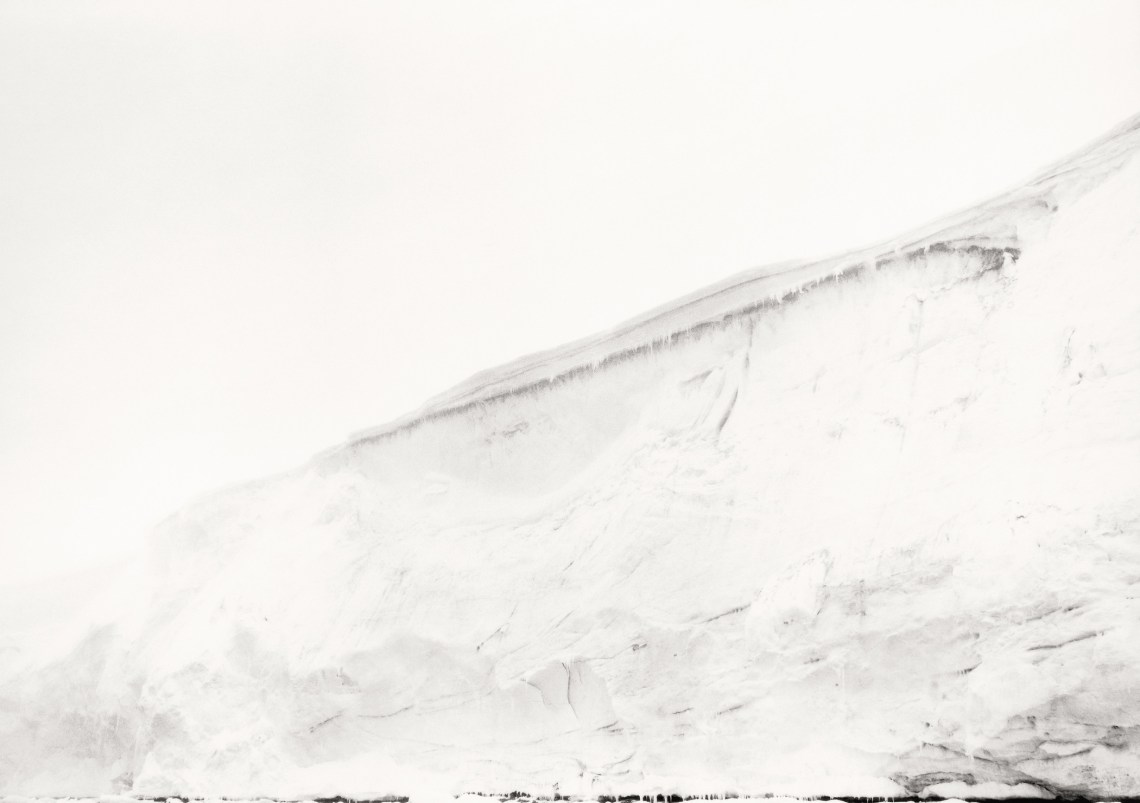
In order to make his outdoor photographs, Thomas Joshua Cooper travels to remote, often isolated sites. He makes one negative per location using a 19th-century Agfa Ansco view camera, then prints each photograph by hand in a traditional darkroom in his studio in Glasgow. Typically, each photograph includes neither a horizon line nor the terrain below the artist’s feet, focusing instead on what Cooper calls the surrounding “sea space.” He composes each scene by determining its edges, one at a time. The resulting black-and-white photographs capture the psychological impact of these places through geographic and atmospheric details. They are not documents, but open, expansive artworks that are free to receive the viewer’s imagination.
In The World’s Edge, Cooper charts the Atlantic basin from its most extreme northern, southern, eastern, and western land points. He began this project of circumnavigation in 1987 and has since made more than 700 contributing photographs, traveling throughout the United Kingdom and to northern Europe, the west coast of Africa, the east coasts of South and Central America, the United States, Canada, and both the North and South Poles. He is the only artist to have captured all of these sites along the Atlantic basin. As climate change causes sea levels to rise, many of the land points pictured in Cooper’s photographs will soon be underwater and no longer accessible.
The exhibition is organized regionally, with 65 large-scale works reflecting the way Cooper made the photographs via extended trips to each area. It begins with a group of works that belong to the theme , which introduces Cooper’s early inspiration to make The World’s Edge: the legacies of 2nd-century Greco- Roman geographer Claudius Ptolemy and 6th-century Irish monastic Saint Brendan the Navigator. Their contributions to mathematics, geography, and navigation pushed Europeans to consider the world beyond themselves, to the west, north, and south.

